 AI
AIHabitat guide
How Vegetation Corridors Help Birds
Vegetation corridors connect habitat patches and can give access to more areas, increase gene flow and population viability, enable recolonization, and provide habitat. They also have limits: they can be dominated by edge effects, increase the risk of parasitism and disease, and facilitate invasive species.
Reviewed:Prepared with AI assistance and linked sources. Illustrations are not field photographs.
The short answer
A vegetation corridor serves, above all, to connect habitat patches. According to the USDA Forest Service conservation buffers guidelines, connecting patches with corridors can benefit biodiversity by providing access to other areas of habitat, increasing gene flow and population viability, enabling recolonization of patches, and providing habitat.
But connection is neither automatic nor always desirable. The same source warns that corridors can be dominated by edge effects, increase the risk of parasitism and disease, and facilitate the dispersal of invasive species. They can also fail if they do not meet the movement or habitat requirements of the target species. In Puerto Rico, the Gap Analysis Project recommends developing viable corridors to connect upland and coastal reserves.
Habitat guide
Three key ideas
ConectarMain functionJoining habitat patches to give access to more areas.
CalidadA passage is not enoughThe corridor should provide quality habitat whenever possible.
LímitesEdge effectsThey can increase parasitism, disease, and invasives.
01
What a corridor is and is not
In the USDA guidelines, a corridor is a connection between habitat patches within a matrix. The resulting connectivity can benefit biodiversity in several ways: access to other areas of habitat, increased gene flow and population viability, recolonization of patches, and provision of habitat. It is not simply a green strip: its function depends on whether the target species can move through it and whether it finds what it needs.
The guidelines also note that connectivity can be undesirable or unsuccessful. A corridor can be dominated by edge effects, increase the risk of parasitism and disease, and facilitate the dispersal of invasive species. So it is worth asking not only whether it connects, but whom it connects and under what conditions.
02
How to design a useful corridor
The USDA's key design considerations include designing corridors at several spatial and temporal scales, providing quality habitat in the corridor whenever possible, locating corridors along dispersal and migration routes, not limiting regional corridors to a single topographic setting, seeking similarity in vegetation between corridors and patches, and restoring historical connections while generally avoiding linking areas not historically connected.
That last point is an important counterweight: not every connection is restoration. The guidance calls for restoring historical connections and generally avoiding linking areas that were not connected. For a local exercise, it is worth reviewing the landscape context before assuming that any green passage is beneficial.
03
The Puerto Rico case
The Puerto Rico Gap Analysis Project documents land cover, vertebrate distributions, and land stewardship. Its recommendations include expanding reserves in the coastal plain, particularly coastal hills and the matrix of wetland and upland vegetation; regulating development on the periphery of existing reserves; and developing viable corridors to connect upland and coastal reserves.
The same report notes that the current reserve system protects a number of important habitats and species and includes 7.6 percent of Puerto Rico, and that expanding it to 15 percent would be more in line with internationally accepted conservation goals. It also states that abandoned agricultural land serves as habitat for a number of species and buffers older forests, wetlands, riparian areas, and reserves, and that these lands have excellent potential for restoration. These are planning arguments, not local abundance observations.
04
Two birds, two ways of using connection
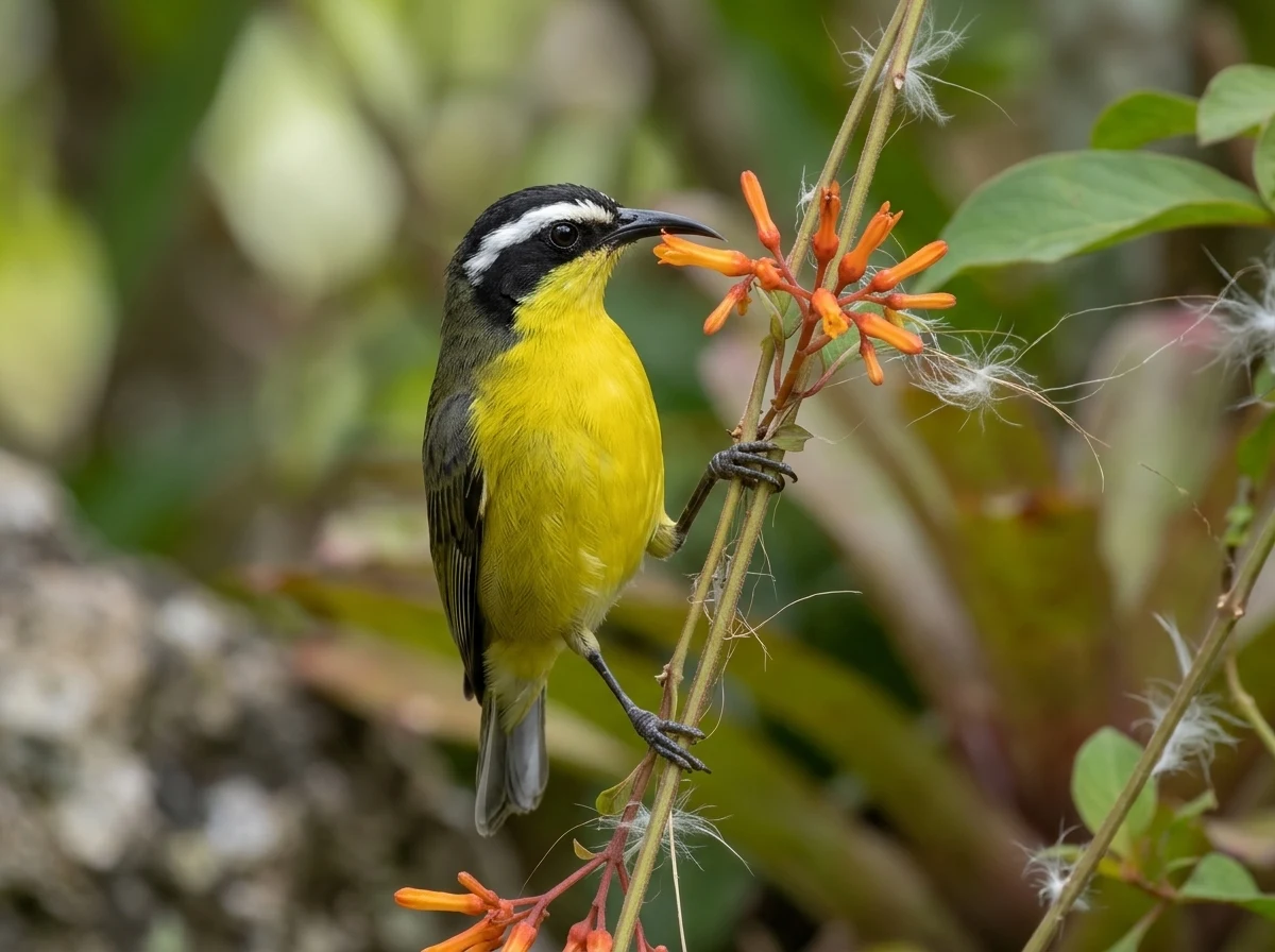
The Bananaquit (Coereba flaveola) is a resident, native bird in Puerto Rico with sedentary habits, inhabiting nearly all wooded and human-modified habitats, including gardens. It feeds on nectar and fruit and is often found in flowering trees and shrubs. For such a species, connection between patches with flowers and diverse vegetation may matter more for continuous access to food than for seasonal movements.
The Puerto Rican Woodpecker (Melanerpes portoricensis) is endemic to the archipelago, resident and native, and inhabits dry and moist forest, mangrove, plantations, parks, and gardens. It feeds on invertebrates and nests in tree cavities, stumps, or poles. For it, connection between patches with mature or decaying trees may matter for access to feeding and nesting sites. In both cases, Puerto Rico occurrence comes from the catalog and local references; no abundance is inferred.
05
Exercise: assess a corridor with a concrete checklist
This exercise is a suggested method, not legal or veterinary instruction. Choose a vegetated edge connecting two patches and walk it slowly. Use this checklist: (1) is the vegetation similar to that of the patches?; (2) are there flowers, fruits, or mature trees?; (3) does the width allow distance from the edge?; (4) are there signs of invasive species?; (5) was the connection historically present?; (6) which birds use the corridor, and how?
Record the time, vegetation type, and observed behavior, without estimating abundance. Repeat the walk in another season if you can. The goal is to compare corridor structure with USDA recommendations and the Gap Project planning context, not to produce an inventory.
Linked profiles
Birds mentioned
Two resident Puerto Rico species that illustrate different uses of patch connection: a sedentary nectarivore and an endemic woodpecker that nests in cavities.
AI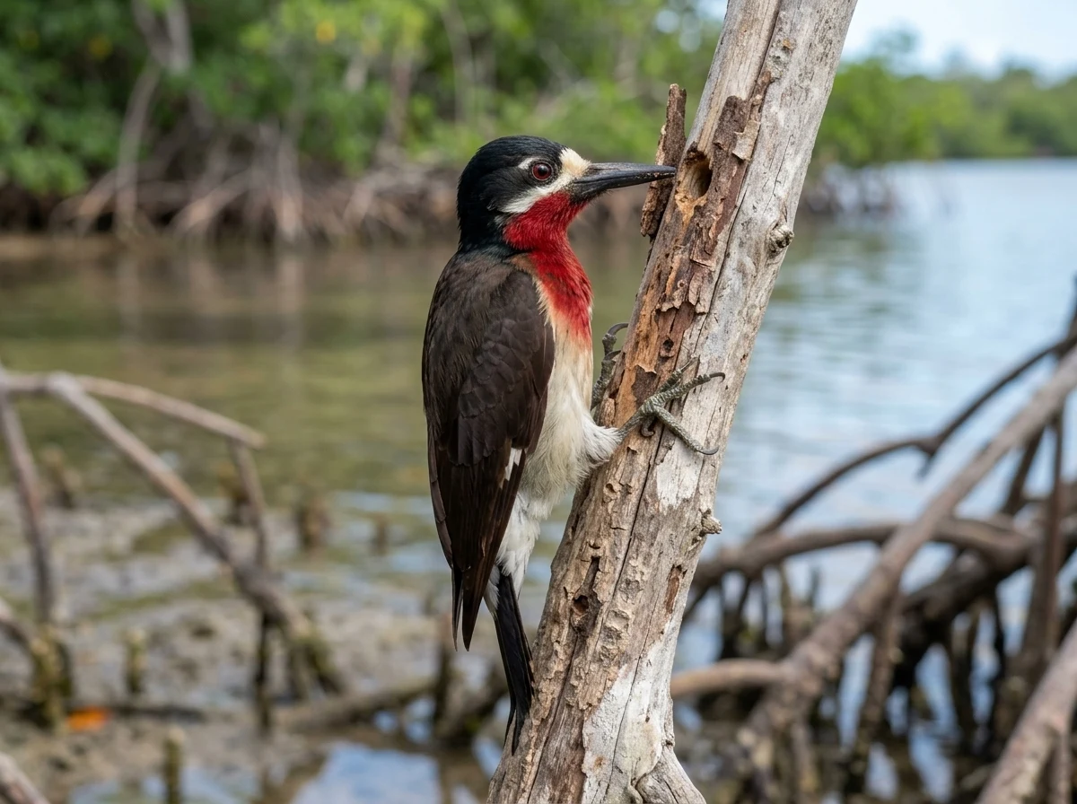 AI
AI01
Does a vegetation corridor always benefit birds?
No. USDA guidelines state that connectivity can be undesirable or unsuccessful: corridors can be dominated by edge effects, increase the risk of parasitism and disease, and facilitate invasive species. They can also fail if they do not meet the movement or habitat requirements of the target species.
02
What makes a corridor useful for birds?
Key considerations include designing it at several scales, providing quality habitat whenever possible, locating it along dispersal and migration routes, not limiting it to a single topographic setting, maintaining vegetation similarity with patches, and restoring historical connections.
03
What does the Gap Project say about corridors in Puerto Rico?
The Puerto Rico Gap Analysis Project recommends developing viable corridors to connect upland and coastal reserves. It also recommends expanding reserves in the coastal plain and regulating development on the periphery of existing reserves.
04
How can I observe whether a corridor is used by birds?
Walk slowly along a vegetated edge connecting two patches and record time, vegetation type, and observed behavior, without estimating abundance. Repeat in another season if you can. This is a suggested observation exercise, not an inventory or professional assessment.
05
Do the Bananaquit and Puerto Rican Woodpecker use corridors the same way?
Not necessarily. The Bananaquit is resident, sedentary, and nectarivorous, and inhabits nearly all wooded and human-modified habitats. The Puerto Rican Woodpecker is endemic, resident, feeds on invertebrates, and nests in cavities. Their connection needs may differ, although both species are documented in Puerto Rico.
Keep exploring
Connected routes
Sources and review
The evidence is one link away.
These sources support the editorial scope of this guide. Bird profiles also retain their own taxonomy, occurrence, and conservation references.
Reviewed:
01↗02↗03↗
USDA Forest Service, National Agroforestry Center
2.3 Corridors and Connectivity
Evidence for cited sections; consult the original document.USDA Forest Service, International Institute of Tropical Forestry
The Puerto Rico Gap Analysis Project Volume 1: land cover, vertebrate species distributions, and land stewardship
Evidence for cited sections; consult the original document.Birds of the World (Cornell Lab of Ornithology)
Bananaquit - Coereba flaveola
Evidence for cited sections; consult the original document.The atlas continues